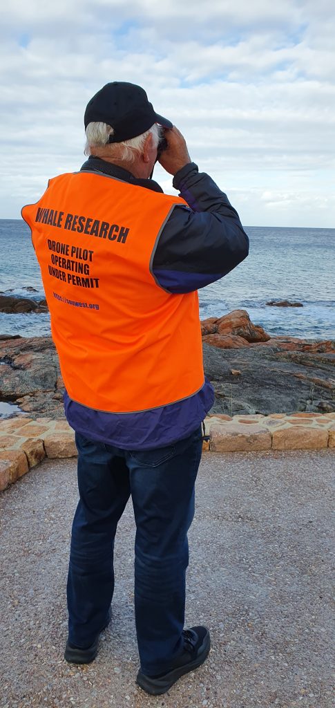
Photogrammetry of whales refers to the process of using photographs to take measurements of features on the whale. These photographs could be taken, for example, by a camera held by a researcher, or they could be taken from a camera carried by an unmanned aerial vehicle (drone) or even a manned aircraft.
Even when the photograph does not have the information needed to scale the photograph, useful information can be obtained. An example would be to measure the total length, and the width. These measurements would have units of pixels. The ratio of width to length can give important information about the body condition of the whale (or other animal).
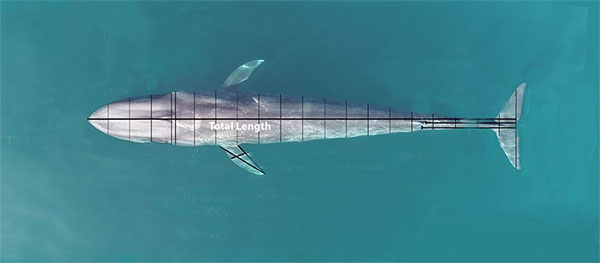
When scale information is available then the measurements can be converted to lengths in meters. When this is done additional information can be obtained, including comparisons with measurements taken of the same animal at a different time, or of individuals of the same species, or even different species elsewhere and at different times.
There are a number of methods used to obtain information to scale the measurements.
- – including something of known length in the same photograph (like a boat)
- – projecting laser dots onto the subject to provide provide scale.
- – using a lidar system
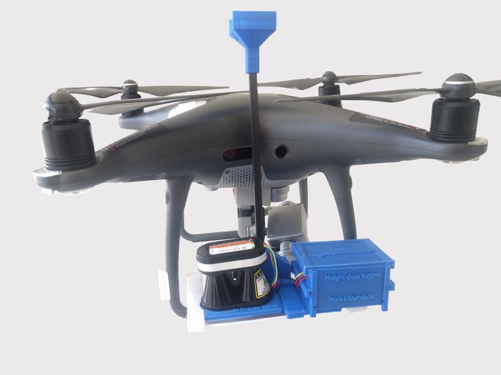
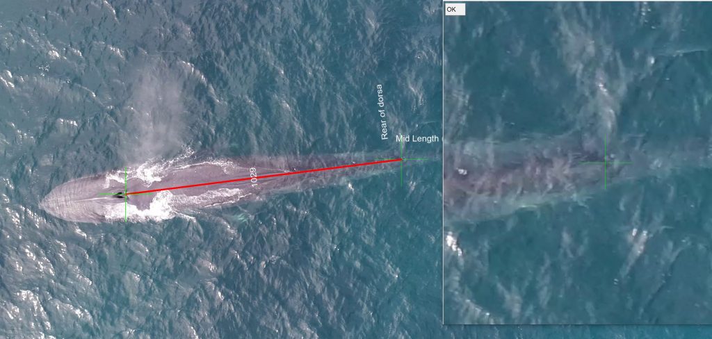
The drone images show the complete length of a whale when it is near the surface, and usually all features on the dorsal side. Hand held lateral shots are useful for many applications, however for photogrammetry they do not provide this. GMR researchers have been using for some time drone photographs without scale to conduct research on different whale species. More recently one of the GMR Directors has developed a Lidar system that can attach to a small drone (DJI P4Pro) and provide accurate height measurements, and using this it is possible to calculate the length between two points in the photograph.
Lidar stands for lIght detection and ranging – just as Radar stands for radio detection and ranging. A laser pulse is sent from the unit, and the time the reflection is detected is measured. This enables an accurate measurement of the distance the laser pulse has travelled. Unfortunately this is not the full story. Drones are not stable and small drones are even less so. The angle of tilt of the drone at the time the height measurement is taken must be measured, and the measured height adjusted to allow for this tilt.
This system takes these measurements and records them (together with the time of the measurement) on a microSD card included in the system.
All this data is subsequently processed back in the office. The height is matched to a photograph or more usually a frame in an image and then by trigonometry the distance between two points on the photograph can be calculated. If only it were that simple. In Geographe Bay the sun is high enough that the drone operator must place the drone between the whale and the sun to avoid the reflected glare. This means taking the photo at an angle and taking this into account in the calculations!
This system was first used in 2020. The post processing software is under development but is sufficiently advanced for use, and requires further development. In 2021 we hope to have a minimum of two Lidar units in use, and possibly a third. The accuracy and repeatability of the system are being checked by measuring objects of known length, such as a dead whale that has been measured on land, measuring objects of known length (such as cricket pitches, lines in car parks, tennis court markings) and calibration against “laser rulers”.
The system is enabling a number of research questions to answered. As an example when Southern Right Whale mothers and calves remain in the area for several weeks we aim to measure the body condition of both over time as the calf grows.